REPORTS AND DATA SOURCES, BORDERS
Is Peace Possible? - Borders
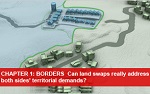
S. Daniel Abraham Center for Middle East Peace (2011)
"Borders" chapter of a comprehensive graphic report narrated by Abraham Center president and former Congressman Robert Wexler. Examines the issue of land swaps and how they can address the territorial demands of both Israelis and Palestinians. See More >
Indefensible: Misrepresenting the borders issue to undermine Israeli-Palestinian Peace
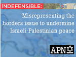
Americans for Peace Now (2011)
APN's honest assessment of the "defensibility" of borders based on the 1967 lines with mutually agreed upon land swaps. PDF >
Imagining the Border: Options for Resolving the Israeli-Palestinian Territorial Issue
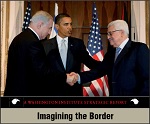
The Washington Center for Near East Policy (2011)
David Makovsky analyzes the intersection of demography and geography in the West Bank in an attempt to demystify the territorial dimension of the conflict and facilitate peacemaking. Detailed maps and in-depth population data help show how the parties can use land swaps to meet some of their most important goals, such as minimizing dislocation, ensuring security, and establishing a contiguous Palestinian state in the West Bank. (read more)
Getting to the Territorial Endgame of an Israeli-Palestinian Peace Settlement
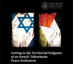
James A. Baker III Institute for Public Policy (2010)
The result of a workshop composed of two teams of experts, each representing Israeli and Palestinian perspectives. Proposes and addresses various land swap scenarios, as well as the effectiveness of a U.S. bridging proposal on the territorial component of peace. PDF >
Future Borders between Israel and the Palestinian Authority: Principles, Scenarios and Recommendations
The Shasha Center for Strategic Studies (2010)
Study that inquires into the possible routes of the border and their nature, what current and potential processes shape these possibilities, and what can or should be down were one of these possibilities to develop. PDF >
Israel-Palestine Permanent Borders

The Geneva Initiative (2009)
Features satellite photo maps of all border areas between Israel and an independent Palestinian state. Shows the border lines proposed by the Geneva Initiative as compared to the Green Line demarcation of 1949. Read More >